

By Gareth Winters
First sightings
The first Europeans to report seeing Wairarapa Moana were Captain James Cook and his crew in 1773. The 17 year old naturalist George Forster reported that it appeared to be a “most convenient spot for European settlement.” He said the extensive land seemed suitable for cultivation, looked as though there was plenty of timber, and “the country does not appear to be very populous, so that there would be little danger of quarrels with the natives.” It was the prospect of land such as this that drew thousands of British settlers to the New Zealand Company settlement in Wellington in 1840.

The Endeavour off the coast of New Zealand
Sheep arrival
The New Zealand Company oversold the agricultural suitability of their new settlement. New settlers expecting flat grassy lands came instead to the steep hills and gullies of Wellington or the flood-prone forests of the Hutt Valley. Unsurprisingly, graziers sought land in the nearby Wairarapa valley, where Māori assured them vast flat areas of grassland awaited their flocks. Surveyor Henry Tiffen reported in 1844 that there thousands of acres of deep, fertile soils around the lakes. He also said that it was prone to flooding but if the lake was kept at a lower level, rich meadow land would be available.

Map of Wairarapa Moana, 1855
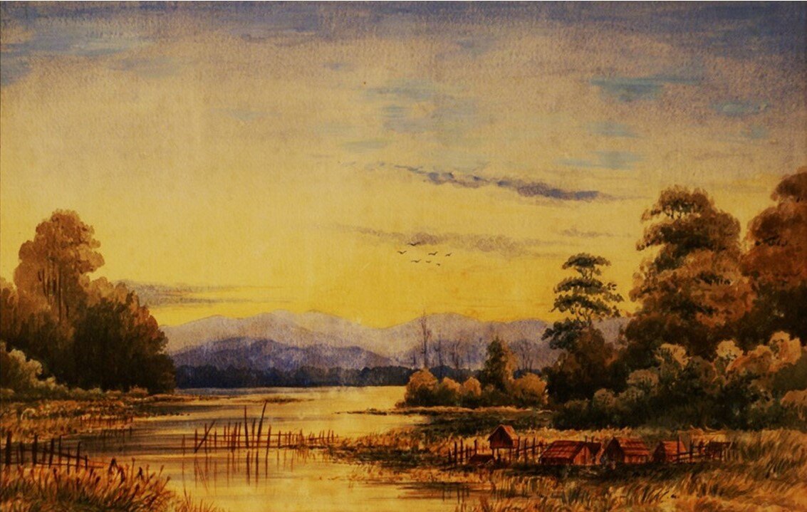
Pāhautea and Wharekākā
The first sheep and cattle stations were established on the shores of Wairarapa Moana in 1844. Charles Bidwill imported 1,600 sheep from Sydney, and arranged to lease land at Pāhautea. Just south at Wharekākā, Frederick Weld and his cousins established what is regarded as the first extensive sheep station in New Zealand. They were soon joined by others on both sides of the lakes. These early graziers found conditions trying – they were assailed by mosquitoes, complained of the frequent floods they experienced, and often had little to eat. They purchased food from their Māori landlords.

Clifford and Weld's Station, Wharekaka, Wairarapa N.Z.
First attempts 1870s
To the first farmers, the natural rise and fall of the waters of Wairarapa Moana was a vexation. They wanted to be able to keep the outlet open at all times, ensuring their pastures were free from flooding. At an 1872 meeting, Peter Hume, farming on the eastern side of the lake, claimed the lake waters were costing him £2000 a year. The farmers wanted the Government to purchase the lake from its Māori owners so they could control the outlet. For the owners, the higher waters of summer and autumn were vital in the harvest of the financially and culturally important taonga (treasure), tuna (eels).
Fishing village,Wairarapa Moana, Near-pirinoa c1860
River Board
When the Native Land Court confirmed Māori ownership and control of the lake in 1882, Pākēha (British / European / foreign) farmers begged the Government to compulsorily take it under the Public Works Act. That failed, and in 1886 they formed the Ruamāhanga River Board. With police escort, they opened the outlet. They did the same in the following years, even after the Royal Commission of Enquiry of 1891 established Māori ownership of Ōnoke Spit. In 1892 the opening was disrupted by peaceful protest by Piripi Te Maari (also known as Piripi Te Maari-o-te-rangi)1 and other Māori. It was not resolved until the lake was gifted to the Crown in a tuku rangatira in 1896. This has been referred to as “The battle of the lakes.” 2
Tuku rangatira (chiefly gift)
After years of contest over control of Wairarapa Moana, tangata whenua, under the leadership of Hamuera Tamahau Mahupuku, made an astonishing decision in 1896 – they gifted the bed to the Crown, explaining it was too important to be sold, but would be given as a gift from one chief to another. They retained rights over the water and the fishery. In return, the Crown promised they would gift lakeside reserves for Wairarapa Maōri. Once again the Government failed Māori - those reserves never eventuated, and in 1916, twenty years after the original tuku rangatira, Wairarapa Māori reluctantly accepted land at Pouakani, hundreds of kilometres away from the lake, north of Lake Taupō.

Opening the lake outlet
Early 20th century stopbanks
In the early 20th century Pākehā farmers on the margins of Wairarapa Moana formed stop banks and river boards with equal relish. Those on the edge of the lake and the Ruamāhanga River constructed stopbanks in an ad hoc and indiscriminate manner, often pushing floods to their neighbours across the water. River boards were not immune to the problem. There were threats to blow up the Kahutara Board’s stopbank, because it was causing flooding on adjoining properties. Things had to change. After the massive floods of June 1947, the newly formed Wairarapa Catchment Board developed a major scheme.

Flooding at Kahutara
Waitangi Tribunal. (2010). The Wairarapa ki Tararua report (Report no. WAI 863) p663
Waitangi Tribunal. (2010). The Wairarapa ki Tararua report (Report no. WAI 863) p644
ABOUT THE AUTHOR
Gareth Winter QSM, is a Masterton-born archivist and historian with special interests in the catchment of the Ruamāhanga River and its environs. He has walked the length of the Ruamāhanga from its origins in the northern Tararua Range to its outlet where Wairarapa Moana meets the sea. The District Archivist with the Masterton District Council for over 23 years, he has written hundreds of articles and over a dozen books on Wairarapa and its people. He has two children and one mokopuna, who he hopes will be able to enjoy Wairarapa Moana and the Ruamāhanga River too.